
Johnson County ZIP Coverage
The county's official AIMS map, dated October 1, 2025, supplies the best countywide view of postal polygons. It labels 34 ZIP areas that touch or appear within mapped Johnson County geography. That is not the same as 34 ordinary residential delivery zones. Some labels sit at an edge, cross a county line, or need an exact-address check. The Johnson County ZIP code directory keeps map evidence and postal validation separate.
| ZIP | Areas covered | Postal context | Research note |
|---|---|---|---|
| 66013, 66018, 66021, 66025 | Bucyrus, De Soto, Edgerton and Eudora edges | Southern, western and cross-county service | Validate each street |
| 66030, 66031 | Gardner and New Century | Gardner delivery; airport and industrial labels | Keep the returned New Century label |
| 66061, 66062, 66063 | Olathe core, east and limited postal context | Two major Olathe zones plus an unclear special case | Do not assign 66063 without USPS |
| 66083, 66085, 66092 | Spring Hill, Stilwell or Stanley, and Wellsville edges | Southern and southwestern service | May cross county context |
| 66202–66208 | Mission, Shawnee, Merriam, Overland Park, Leawood and Prairie Village | Northeast county network | Last lines do not trace city borders |
| 66209–66219 | Leawood, Overland Park, Lenexa and Shawnee | Central and northeast delivery | Use the exact street for overlaps |
| 66220–66227 | Lenexa, Overland Park and Shawnee | West and south suburban delivery | Growth can change local context |
| 66114 | AIMS-labeled industrial or edge geography | No normal current example confirmed | Verify with USPS |
This grouped inventory preserves all map labels without claiming more than the sources show. Search a specific address whenever the exact postal code matters.
Johnson County Olathe ZIP Layers
Olathe records often use 66061 for central and northwestern areas and 66062 for eastern and southeastern areas. The line between them is postal, not an Olathe city-limit line. County tax, court, election, and city records may all hold a valid address while displaying different service geography.
The 66063 label needs extra care. Captured official pages did not establish a normal current address-level example, so do not assign it from a city name or nearby parcel. Run the street through the USPS ZIP Code Lookup. Save the preferred last line and ZIP as returned. Then compare AIMS for municipality, parcel, districts, and legal description.
Note: A city name beside a ZIP is useful context, but only the exact-address result settles the mailing answer.
Northeast Johnson County ZIP Directory
The 66202 through 66227 run covers much of northeast and central Johnson County, but the numbers do not divide neatly by city. Historical USPS bulletin material associates Mission with 66202 and 66205, Prairie Village with 66208, Shawnee with 66203, 66216, 66217, 66218, and 66226, and Lenexa with 66215, 66219, 66220, and 66227. Several Leawood and Overland Park labels overlap municipal edges.
Use those associations as search hints, not timeless rules. The postal bulletin documents preferred-last-line changes from 2001. A current street query controls. In AIMS, keep postal ZIP, municipality, taxing district, school district, voting district, and commissioner district as distinct fields. Combining them into one location can send a resident search to the wrong office.
The mismatch is common because the county spans 473.63 square miles and has many fast-growing cities. Subdivisions and annexations often created city labels newer than a parcel deed chain or older directory entry.
Johnson County Edge ZIP Checks
Southern and western ZIPs need county verification. USPS identifies Bucyrus 66013, Edgerton 66021, Gardner 66030, Spring Hill 66083, and Wellsville 66092. The AIMS map adds De Soto 66018, Eudora-area 66025, Stilwell or Stanley-area 66085, and other edge polygons. A postal area can extend beyond Johnson County, so a familiar city label does not prove the parcel sits inside the county.
The Spring Hill post office page corroborates 66083 and lists nearby ZIPs including 66061, 66062, 66223, and 66013. The Wellsville facility page corroborates 66092 and nearby 66021 and 66030. Facility pages show context, not the code of each nearby road.
Edge check. For 66063 or 66114, display the gap and require a USPS query using the full street address.
Find Johnson County Residents by ZIP
A ZIP narrows the area, but official systems use it in different ways. AIMS accepts a ZIP as a map or search field and can connect the polygon to parcels. Taxbill is strongest with a Quick Reference ID, address, owner, or business name. VoterView checks one name and birth date, while a broader Elections file requires a written request.
- Validate the full address with USPS and save the returned ZIP and preferred city line.
- Open AIMS Online Mapping, search the ZIP or address, and identify the parcel. Record the map date.
- Check Johnson County Taxbill by address or owner. Confirm the parcel and legal description.
- For a known person, use VoterView with first name, last name, and date of birth. It is not a street-wide directory.
- Once the ZIP narrows to a road, use the Johnson County street directory for address-level work.
A county or district voter-file request can include ZIP-bearing residential and mailing addresses, precinct, districts, registration date, and voting history. Johnson County Elections lists a $50 countywide or district file. The request is written, actual response costs can apply, protected ID fields are removed, and statutory restrictions remain.
Johnson County ZIP Search Fields
Postal and county map tools answer different questions. USPS returns the mailing form for an address. AIMS locates it within a polygon and adds county layers. Taxbill links the site to a tax account. Keep the fields apart.
| Source field | Input | Purpose | Limit |
|---|---|---|---|
| USPS street, city and state | Address | Returns mailing ZIP and preferred last line | Needs a deliverable address |
| USPS city and state | Place | Lists associated postal codes | Does not resolve one street |
| USPS ZIP | Five digits | Returns postal city information | Does not prove city limits |
| AIMS ZIP or address | Map search | Shows polygon, parcel and layers | May lag route changes |
| Taxbill address or owner | Text | Connects site to owner, QREF and tax detail | Not an occupant list |
Do not infer a postal code from a parcel centroid or city name. A polygon can be stale after route changes or development.
New Century ZIP Record Test
New Century is a useful Johnson County test because Sheriff material uses New Century, KS 66031, while airport, industrial, parcel, jail, and postal records may describe the same area differently. Search one known address through USPS, AIMS, Taxbill, the court or sheriff source, and the Register of Deeds. Copy each geography as returned.
This prevents a service label from being mistaken for an incorporated city. It also shows why ZIP-based lists need source dates. A parcel can keep the same legal description while its postal last line, commissioner district, or service layer changes.
The Johnson County ZIP code directory uses New Century as an insider check: if two official records disagree on a place label, compare their purpose instead of choosing the familiar one.
Measure Johnson County ZIP Context
Countywide statistics describe scale, not individual residents. Census QuickFacts gives a 2024 population estimate of 632,276, while the 2024 American Community Survey subject table reports 620,631 for its own survey product. Do not mix these figures. Neither can be divided into a ZIP resident count without a suitable ZIP-level dataset.
Review the 2024 ACS Johnson County profile captured for this Johnson County ZIP code directory.
The table is county context only. Label its survey year and product whenever it appears beside postal geography.
The county's Our Beginnings history provides a second geography check, from the original 476-square-mile county description to the shift of the county seat from Gum Springs to Olathe.
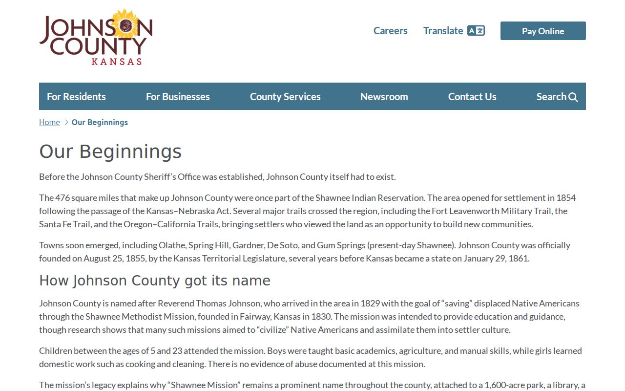
That history explains why an early record may use a place label that does not match today's postal directory.
The Kansas Historical Society county profile adds the authoritative county identity, seat, cities, and establishment context.
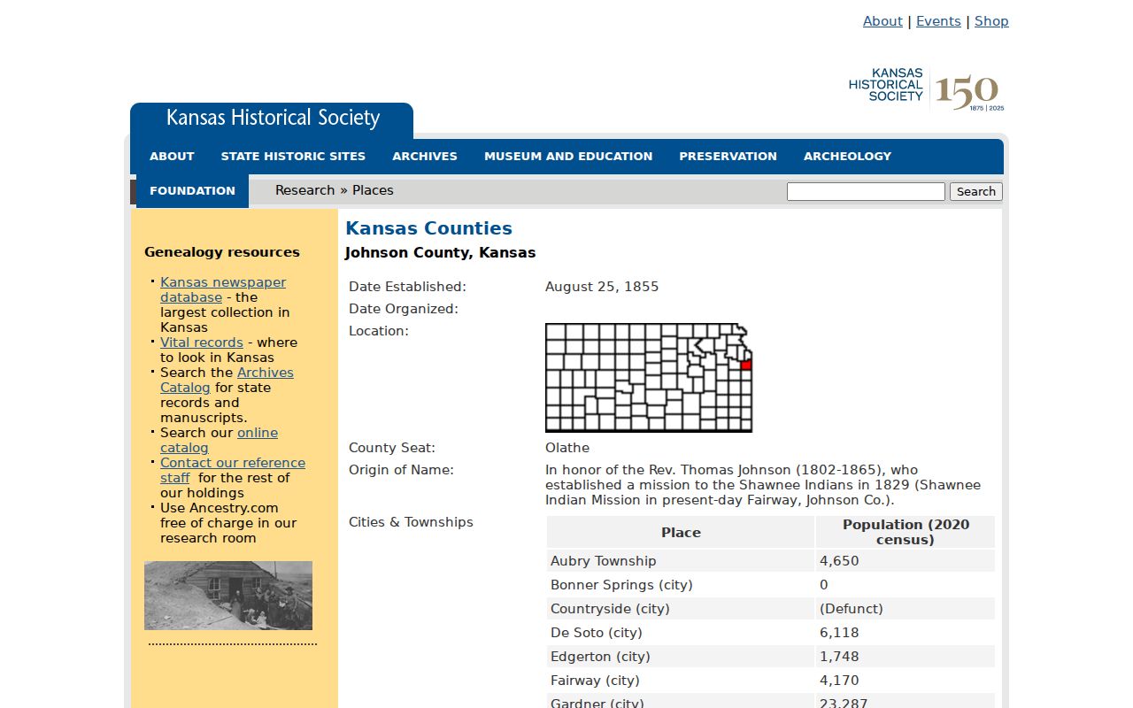
Use it to confirm historical jurisdiction, then return to USPS and AIMS for the current address and ZIP.
Johnson County ZIP and City Limits
A ZIP polygon supports mail sorting. A city limit defines municipal jurisdiction. A parcel legal description identifies land, and a carrier route organizes delivery. Those boundaries overlap without matching. AIMS provides geographic evidence, but USPS controls the mailing answer for an exact address.
- ZIP and ZIP+4
- A five-digit delivery area and its smaller delivery segment, such as one block side or box group.
- PO-box ZIP
- A code used chiefly or solely for post-office boxes.
- Unique ZIP
- A code assigned to one high-volume destination. The research did not confirm one for Johnson County.
- Carrier route
- The addresses served by one delivery route, which need not follow a city boundary.
When jurisdiction matters, save five values: postal city and ZIP, municipality, county, parcel or legal description, and source date. That record prevents most boundary errors in a Johnson County ZIP code directory search.